


-
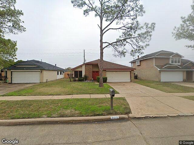
8119 VISTA DEL SOL DR HOUSTON, TX 77083
- Single Family Home / Resale (MLS)


Register to view full details of all properties including foreclosures, Hud Homes and more. View Homes
Property Details for 8119 VISTA DEL SOL DR, HOUSTON, TX 77083
Features
- Price/sqft: $164
- Lot Size: 0.14 acres
- Total Units: 1
- Stories: 1
- Roof Type: Composition Shingle
- Heating: Central, Electric, Heating
- Exterior Walls: Masonry
Facts
- Year Built: 01/01/1983
- Property ID: 994066425
- MLS Number: 3843773
- Parcel Number: 5030-06-023-0520-907
- Property Type: Single Family Home
- County: FORT BEND
Contact Info for 8119 VISTA DEL SOL DR, HOUSTON, TX 77083
This is NOT a Foreclosure listing. It is a traditional Resale (MLS) listing. Negotiate your purchase with the sellers agent.
Agent(s)
Candice Jackson
eXp Realty LLC.
eXp Realty LLC.
Price Information
FirstAmerican Estimates
- Market Value : $269,701
- Low Value : $226,281
- High Value : $313,121
- Confidence Score : 79%
Local Info for 8119 VISTA DEL SOL DR, HOUSTON, TX 77083
Education 77083
- Not High School Graduates 27.68%
- Some College 26.30%
- Bachelor’s Degree 13.96%
- Graduate Degree 5.95%
- Closest Two-year Public College
REMINGTON COLLEGE-HOUSTON (5 miles) - Closest Four-year Public College
AMERICAN CLLG ACUPUNCTURE-ORNTL MEDCN (8 miles)
Age 77083
- Infants and Children: 9,065
- Teens: 2,654
- 20 - 39 yrs old: 12,677
- 40 - 59 yrs old: 11,863
- 60 + yrs old: 5,316
Income 77083
77083 - HOUSTON, Texas
- Median Per Capita Income: $56,006
- Median Household Income: $57,046
- Average Household Income: $72,098
- Average Individual Income: $20,672
- Income Change Since 2010: $6.82
Texas
- Median Per Capita Income: n/a
- Median Household Income: $66,790
- Average Household Income: $92,511
- Average Individual Income: $33,142
- Income Change Since 2010: $19.54
Crime 77083
77083 - HOUSTON, Texas
- Total Crime Risk : 135
- Personal Crime Risk : 320
- Murder Risk : 304
- Rape Risk : 252
- Robbery Risk : 432
- Assault Risk : 309
- Property Crime Risk : 336
- Burglary Risk : 318
- Larceny Risk : 255
- Motor Vehicle Theft Risk : 380
Texas
- Total Crime Risk : 229
- Personal Crime Risk : n/a
- Murder Risk : n/a
- Rape Risk : n/a
- Robbery Risk : n/a
- Assault Risk : n/a
- Property Crime Risk : n/a
- Burglary Risk : n/a
- Larceny Risk : n/a
- Motor Vehicle Theft Risk : n/a
Environment 77083
77083 - HOUSTON, Texas
- Average Annual Rainfall : 49.04
- Air Pollution Index : 92.00
- Average July Temperature: (°F) 84.10
- Average July High Temperature: (°F) 93.70
- Average January Temperature: (°F) 51.80
- Average January Low Temperature: (°F) 41.60
Texas
- Average Annual Rainfall : 28.51
- Air Pollution Index : 89.00
- Average July Temperature: (°F) 82.30
- Average July High Temperature: n/a
- Average January Temperature: (°F) 45.40
- Average January Low Temperature: (°F) 32.58
Demographic 77083
Ethnicity
- White: 39,242
- Black: 1,173
- Indian: 114
- Asian: 318
- Hawaiian: 19
- Other Race: 709
- Hispanic/Latino: 776
Gender
- Male: 48.62%
- Female: 51.38%
Neighborhood 77083
77083 - HOUSTON, Texas
- Population: 75,719
- Number of Households: 21,709
- Family Households: 18,161
- Average Family Size: 4.05
- Population Density (persons per square mile): 7,350
- Population Change Since 2010: 7.23%
- Closest Major Airport: William P Hobby (23 miles)
- Closest Major Sports Team: HOUSTON TEXANS (14 miles)
Texas
- Population: 29,743,320
- Number of Households: 10,561,295
- Family Households: 7,465,310
- Average Family Size: 3.55
- Population Density (persons per square mile): 114
- Population Change Since 2010: 18.28%

Real Estate Professional In Your Area
Are you a Real Estate Agent?
Get Premium leads by becoming a HudForeclosed.com preferred agent for listings in your area

All information provided is deemed reliable, but is not guaranteed and should be independently verified.